Think seriously about purchasing a hand-held GPS. The route is not well-marked and it is easy to get lost.
A typical hand-held GPS
You can load in the maps from Wikiloc.
Smart phone. An alternative is a smart phone. There is good coverage on the Ignatian Camino and you can follow the route using Google maps. The only issue is that sometimes a smart phone will need to be recharged during the day. There are devices that allow you to do that.
iPhone 6

Samsung Galaxy
A dedicated handheld GPS has satellite reception and does not rely on network coverage, has more powerful navigation features, and a better battery life than a smartphone with a map application. However, a smartphone app may be all you need.
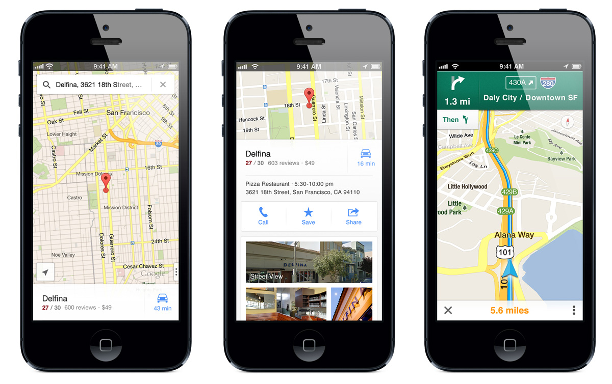
Google Maps can be downloaded from Apple’s App Store, for both the iPhone and iPad.

For GPS, I found the best solution for myself while walking the Camino Ignaciano was to use my iPhone (no need to buy another device), the app Maps.me (it’s free and easy to use) and the GPS tracks from the http://caminoignaciano.org/en (also free). Maps.me can be pre-loaded with the maps of northern Spain at home, then when on the trail, there is no need to use data. I keep my phone on airplane mode and I can easily see on the map where I am, where I need to be when I wandered off trail and how to get back on the trail. FYI, I have no interest in Maps.me. I’m just very pleased with the app.